In today’s fast-paced construction environment, project managers face an ever-growing list of responsibilities — from coordinating subcontractors to tracking timelines and budgets. Traditional methods of overseeing construction progress, such as manual walk-throughs and static photos, often fail to provide the full picture needed to make timely, informed decisions.
Enter drone aerial photography: a game-changer for construction project management.
By integrating high-resolution aerial imagery and real-time site data, drones empower project managers to monitor construction sites with unprecedented clarity and control. In this article, we’ll explore how drone photography is transforming the construction industry and why it’s becoming an essential tool for modern project managers.
Managing a construction project is like orchestrating a live symphony — hundreds of moving parts must come together harmoniously, on time, and on budget. Yet, despite sophisticated scheduling tools and project management software, lack of visual oversight remains a blind spot.
Project managers need a way to stay on top of every phase of the build without physically being everywhere at once. That’s where drone photography shines.
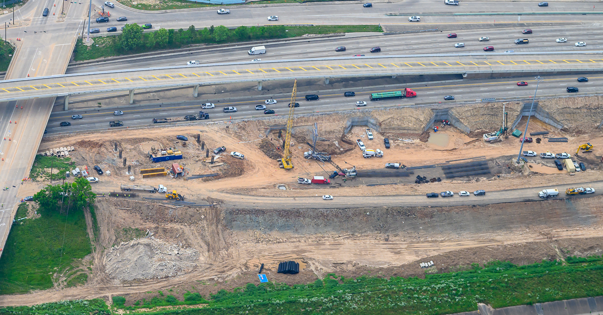
Drone aerial photography uses unmanned aerial vehicles (UAVs) equipped with high-resolution cameras to capture detailed images and videos from above a job site. These photos can be stitched into maps, time-lapse videos, or 3D models for comprehensive visual documentation.
At AirBorn Imaging, our FAA-certified drone operators fly over your site on a schedule you choose — weekly, monthly, or milestone-based — and deliver crisp, geo-referenced images that give you a bird’s-eye view of progress.

Forget walking the entire site — one drone flight provides visuals of the entire job site. You can compare images from different weeks to evaluate progress, spot bottlenecks, and anticipate issues before they escalate.
Use Case:
A Houston-based contractor used our drone photography services to monitor the concrete pouring schedule across multiple foundations. With aerial views, they were able to identify delays and reallocate crews quickly.
When you can show, not tell, everything gets easier.
Drone images are easy to share with clients, investors, or regulatory agencies. Aerial views help external stakeholders understand site conditions, timelines, and changes without needing technical drawings.
Benefits:
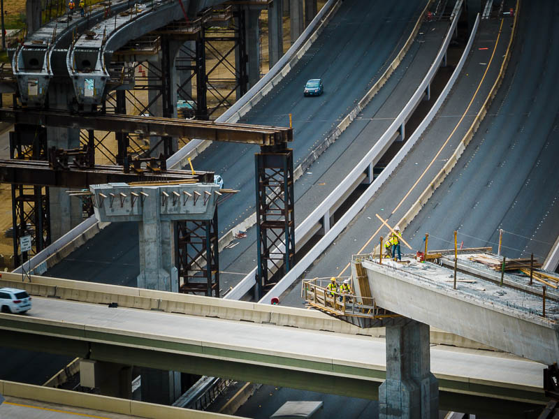
Flying a drone over your site eliminates the need to send personnel into potentially hazardous zones just to get photos. This not only reduces liability but also gives you access to difficult-to-reach areas (e.g., rooftops, crane-level shots).
Need proof for permitting? Handling an insurance claim? Drone imagery can provide timestamped, high-quality evidence that’s easy to store and reference.
We often work with construction firms that use drone footage to:
| Feature | Traditional Methods | Drone Photography |
|---|---|---|
| Coverage | Ground-level, limited | Full site, aerial view |
| Time Efficiency | Manual walk-throughs required | Automated and scheduled flights |
| Accuracy | Subjective interpretation | Objective, geotagged visuals |
| Shareability | Limited distribution | Easy to share, cloud-based access |
| Historical Record | Sparse or inconsistent | Weekly/monthly progress archives |
Drone photography doesn’t replace project managers — it enhances their ability to lead with data, clarity, and speed.
At AirBorn Imaging, we make it easy for construction companies to get started with drone aerial photography.
Track multi-phase projects, from excavation to final inspection. Use images for investor updates and client reports.
Capture neighborhood-wide views to manage multiple lots simultaneously. Ideal for planning, permitting, and marketing.
From roads to bridges to pipelines, drone photography helps document vast or remote areas that are hard to cover on foot.
Get before-and-after comparisons or plan logistics with high-res rooftop views.
We’re not a fly-by-night drone service — we’re seasoned aerial photographers who know Houston’s construction landscape. We understand FAA regulations, site security requirements, and how to capture images that drive decision-making.
We’ve worked with:
Whether you’re building an interstate highway, a downtown high-rise or a suburban school, we can deliver the visuals you need — when you need them.
Want to see your entire job site at a glance? Tired of delayed updates and incomplete reports?
AirBorn Imaging offers reliable, professional drone aerial photography for construction project managers across Houston and beyond. Whether you’re building up, out, or underground — we’ll capture your progress with precision and speed.
📅 Schedule a consultation or request an estimate today — and see how aerial imagery can transform your project management strategy.